


How to Highlight Countries, States, and Cities on a Map
An animated highlight turns geography from a backdrop into the subject. Instead of asking viewers to find a country on a busy map, you draw its outline in front of them, and their eyes go exactly where you want. This guide shows you how to highlight countries on a map, plus states and cities, using the Mappi Highlight tool: selecting the region, styling its outline and fill, and timing the reveal. It is the technique behind every election-night graphic and the backbone of a good political map.
Why animated outlines hold attention
A static tint on a country is information. An outline that draws itself is an event. Motion is what pulls the eye on a map, and a highlight that traces the border and then floods with a fill gives the viewer two beats: recognition of the shape, then confirmation of the area. That rhythm matters because highlight moments usually carry the key fact of the video: the country a trip covers, the state a report is about, the city where a story happens. The mistake to avoid is treating highlights as decoration. Every highlight should answer a question the narration or on-screen text is asking at that exact moment. If nothing in the script refers to the region, the highlight is noise, and the video reads cleaner without it.
Timing follows the same logic as camera work. A highlight that appears while the camera is still moving competes with the route for attention, and both lose. Let the camera arrive first, hold for a beat, then start the outline. Viewers process one motion at a time, and sequencing the two reads as confidence: the video knows what it wants you to look at, and when.
Highlight countries on a map in five steps
- Open the Highlight tool and pick the region. Search for any country, state, or city and Mappi snaps to its real administrative boundary. You never trace shapes by hand, which is what keeps outlines crisp at every zoom level.
- Set the outline color and width. Pick a color that contrasts with both your land and water colors, since a border usually touches both. A slightly thicker outline reads better in motion than it looks on a still frame.
- Choose the fill color and fill opacity. Keep the opacity low, around 20 to 40 percent, so labels and roads stay legible underneath. The fill confirms the area; the outline does the storytelling.
- Time the reveal to the camera. Set the highlight to draw during the route leg that arrives in the region, so the border finishes tracing as the camera settles. A reveal that ends together with the camera move feels choreographed instead of pasted on.
- Press play and check two zoom levels. Preview once at the zoom where the highlight appears and once a step wider. An outline weight that works close up can vanish at a distance, and a fill that looks subtle up close can turn muddy in a wide shot.
Styling highlights to match your map
Highlight colors live inside the palette you built in the Style panel, not on top of it. The safest pattern is your accent color for the outline and the same hue at low opacity for the fill. On dark map styles, warm outlines like amber or coral read as premium; on light editorial styles, a saturated brand color holds up better against pale land. If you highlight several regions in one video, resist giving each its own color unless the colors carry meaning, as in a comparison. A single consistent highlight color teaches viewers "this is the marker of importance" after its first use. For the base palette underneath, our custom map styles guide covers the land, water, and label decisions that make a highlight pop instead of clash.
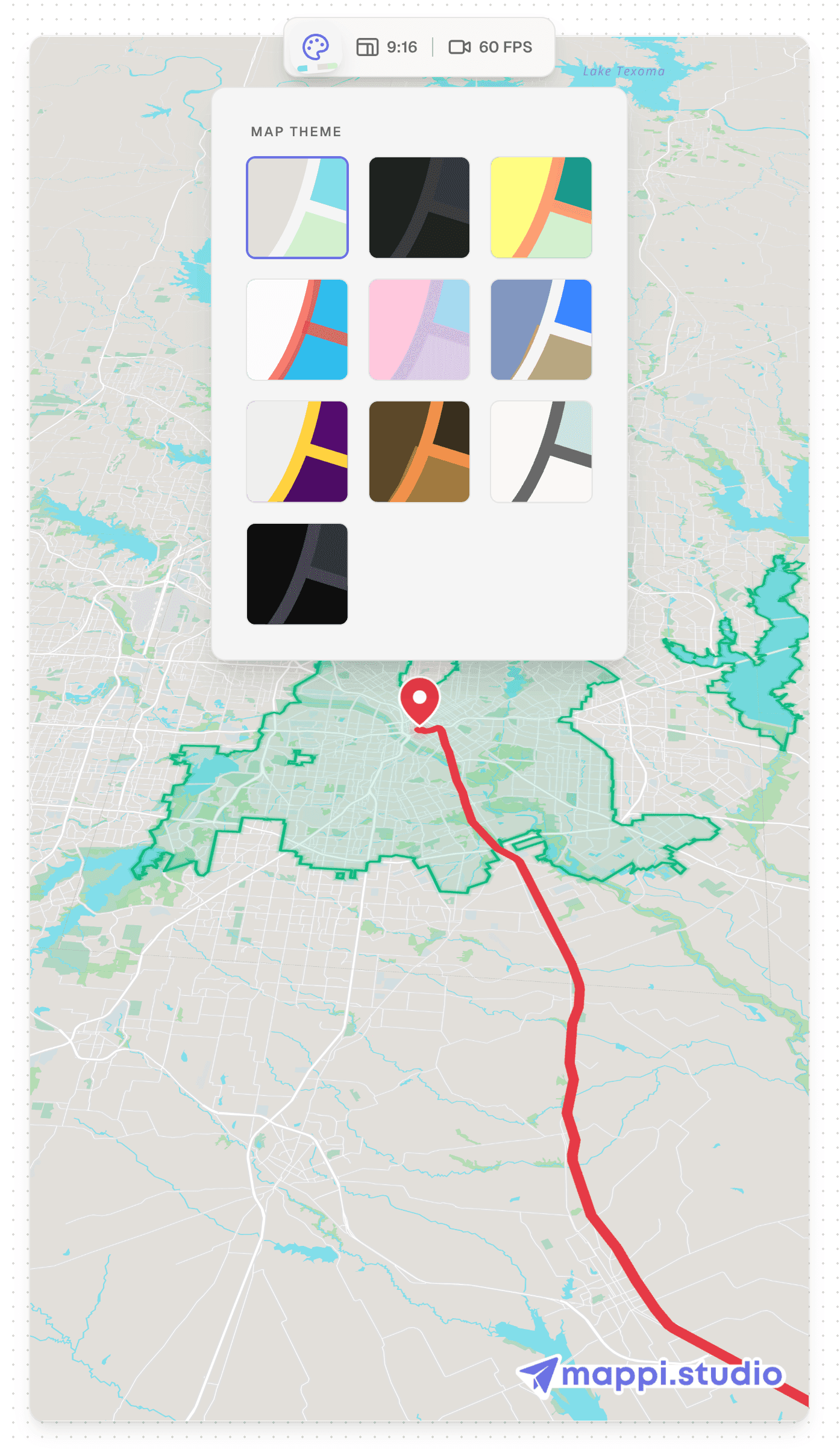
States and cities need different framing
Country highlights forgive wide cameras because continents give the shape context. States and cities need tighter zoom decisions because their outlines are less recognizable on their own. Frame a state with its neighbors partially visible so the viewer gets shape plus context, and frame a city at the zoom where its name label is clearly readable, letting the highlight and the label confirm each other. If a city boundary is oddly shaped, and many are, favor the fill over the outline: viewers recognize the label and the patch of color, not the municipal border. For a sequence that highlights several regions in a row, keep the camera framing consistent between them; matching shots make the comparison land, while a different zoom for every region makes the sequence feel like separate videos stitched together.
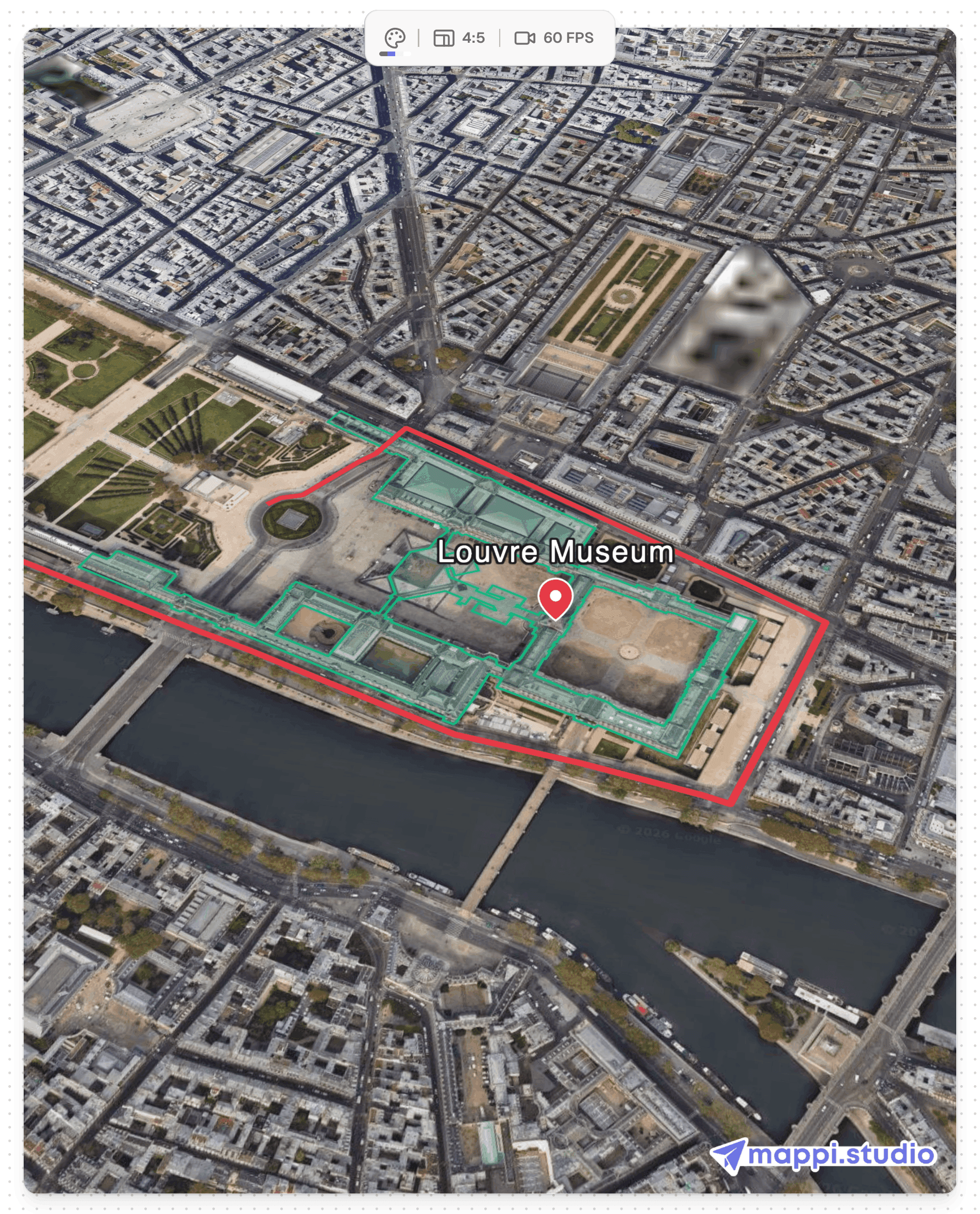
What to do next
Highlights are a payoff layer: they work best over a settled map style and a well paced route. Browse our map animation tutorials for the rest of the series, or continue with the related guides below.
