News map animation
at newsroom speed.
Turn a dateline into a broadcast-ready animated map before the rundown locks. Locator maps, region highlights, storm tracks, election maps, and route explainers for TV, digital, and social news. Export in 4K or as a transparent overlay and get it on air.
No credit card required
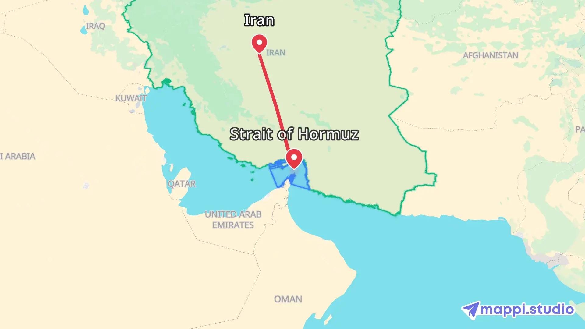
Every news map graphic your rundown calls for.
From a five-second locator to a full explainer package, build the animated map the story needs and export it in the format your desk publishes to.
Breaking news locator maps
Answer "where is this happening?" in the first seconds of the segment with a globe-to-city zoom and a pulsing location marker.
Explainer & backgrounder maps
Walk viewers through borders, regions, and routes step by step for context pieces, VO explainers, and digital video packages.
Election & political coverage
Highlight states, districts, and constituencies as results come in, with brand colors for each party or candidate.
Severe weather & storm tracks
Animate hurricane paths, wildfire spread, flood zones, and evacuation routes as the forecast cone updates.
Conflict & security reporting
Map frontlines, strikes, troop movements, and humanitarian corridors with restrained styling and clearly labeled locations.
Transport, crime & incident maps
Trace a diverted flight, a crash site, a police pursuit, or a chain of incidents across a city in one animated sequence.
Made for newsrooms, graphics desks, and independent journalists.
Whether you cut for the 6 p.m. broadcast, a digital vertical, or a newsletter video, Mappi gives you news map graphics without a dedicated map artist or a broadcast graphics seat.
Broadcast news producers
Ship the locator, the storm track, and the election map yourself when the graphics queue is already full.
Graphics & motion design desks
Clear routine map requests in minutes and keep your Vizrt, XPression, or After Effects time for the big packages.
Digital & social news video teams
Export vertical 9:16 news maps for Reels, TikTok, YouTube Shorts, and the app feed alongside the 16:9 broadcast cut.
Local TV stations & affiliates
Give every producer on the desk a way to build an on-brand animated map without waiting on network graphics.
Data & investigative journalists
Turn a spreadsheet of locations into a sequenced animated map that carries the investigation on screen.
Independent journalists & newsletters
Match the visual polish of network news maps for your YouTube channel, podcast video, or paid newsletter.
News explainer & current affairs channels
Build the animated map sequences viewers expect from network and streaming explainers on a one-person budget.
International & foreign desks
Orient a domestic audience to an unfamiliar region with a clear zoom, highlighted borders, and readable place names.
Map animation tools built for the news cycle.
Real map data, one-click highlights, and clean exports that drop straight into the edit or the studio feed.
One-click country & region highlights
Click any country, state, province, or district and get an animated fill and outline. No shapefiles, no tracing.
Globe-to-street locator zooms
Fly from the world view to a single street with smooth easing. The classic "where it happened" open, ready in seconds.
Animated routes, arrows & paths
Draw flight paths, convoy routes, evacuation corridors, storm tracks, and pursuit routes with real road, rail, and air geometry.
Labels, callouts & markers
Name cities, mark incident sites, and add dates or figures with broadcast-legible type and custom icons.
Station brand colors & themes
Match land, water, borders, routes, and labels to your channel palette so every map looks like your newsroom made it.
Transparent overlays for the studio feed
Export alpha-channel WebM to key over a video wall, a lower third, or the anchor shot in your switcher or NLE.
16:9, 9:16 & 1:1 exports
One map, every platform: widescreen for air, vertical for social news, square for the feed.
Browser-based, no graphics seat
No Vizrt license, no After Effects, no render farm. Open a tab, build the map, download the clip.
From wire alert to on-air map in four steps.
Built to fit the rundown, not the other way around.
- Step 1
Drop in the dateline
Search the city, address, or coordinates from the wire copy. Add every location the story touches and set the order.
- Step 2
Add the context
Highlight the affected country or region, draw the route, storm track, or flight path, and label the places the anchor will name.
- Step 3
Match the brand
Apply your station theme, set the camera pace to the read time, and pick 16:9 for air or 9:16 for social.
- Step 4
Export and air
Render a 4K MP4 or transparent WebM and drop it into the NLE, the playout system, or the CMS in minutes.
Traditional broadcast map graphics versus Mappi.
The usual map pipeline was built for a graphics department. Mappi is built for whoever is holding the story when the clock is running.
The old map graphics pipeline
- File a request with the graphics desk and wait in the queue
- Source basemaps, boundaries, and shapefiles by hand
- Keyframe the camera and route in After Effects or a broadcast CG
- Render, review, revise, and re-render as the story changes
- Rebuild the same map for vertical and social cuts
News map animation with Mappi
- Search the place, click the region, done in minutes
- Live map data with borders, roads, and labels built in
- Camera moves, highlights, and routes animate automatically
- Edit any detail and re-export in minutes when facts update
- Switch aspect ratio and export again without rebuilding
Get an accurate, on-brand animated map to air before the story moves on.
News map animation has always been a bottleneck: the story breaks, the graphics queue fills, and the locator map lands after the anchor has already read the intro. Mappi is a browser-based map animation tool that gives producers, reporters, and graphics desks a broadcast-ready animated map in minutes, with real map data and frame-accurate rendering.
You get the visual grammar news audiences already trust: a clean zoom that establishes where, an animated highlight that shows which region, and a drawn-on route that explains how events moved. Every element stays editable, so when the storm cone, the frontline, or the list of affected towns changes, the fix is a two-minute edit instead of a new graphics request.
Exports are clean MP4 or transparent WebM files. Drop them into Premiere Pro, Avid, DaVinci Resolve, or Final Cut, key them over a studio wall, or post the vertical cut straight to social. Your map matches your brand because you control every color and label.
For a step-by-step newsroom workflow, read the news producer's guide to fast animated map graphics. Covering an election? See how Mappi handles political map animation, or follow our walkthrough on visualizing hurricane paths with animated maps.
Clarity over spectacle.
A news map has to be right before it is dramatic. Mappi is designed so the geography stays accurate and the motion serves the story.
Accurate boundaries and place names
Country, state, and city data comes from maintained open map sources, so borders and labels reflect the real map, not a traced approximation.
Restrained, adjustable motion
Control camera speed, highlight timing, and route pacing so the animation clarifies sequence and scale instead of dramatizing it.
Consistent, brand-compliant styling
Save your palette and reuse it across every map so viewers see one visual standard from the morning show to the late broadcast.
Animated map ideas for the stories you cover every week.
The most common news map graphics producers and journalists build with Mappi.
Hurricane & storm track maps
Animate the storm path from formation to landfall and highlight the coastal counties under evacuation orders.
Wildfire & flood spread
Show a fire perimeter or flood zone expanding day by day with highlighted regions and labeled towns.
Election night results
Fill states or districts in party colors as they are called, then pull back to the national picture.
Airstrike & incident locators
Pin each reported strike or incident, connect them in order, and zoom to the affected neighborhoods.
Refugee & migration routes
Trace displacement corridors across borders with a drawn-on route and highlighted origin and destination countries.
Diverted flights & shipping disruptions
Follow an aircraft or vessel track, mark the point of diversion, and show the ports or airports affected.
News map animation FAQs
Quick answers to the questions news producers, editors, and journalists ask before their first animated map graphic.
How do I make an animated map for a breaking news story?
Search the location, click the country or region to highlight it, add any routes or markers the story needs, choose your station colors, and export. Mappi renders a broadcast-ready MP4 or transparent WebM in minutes, so the locator map is ready before the segment airs.
Do I need Vizrt, XPression, or After Effects to make news map graphics?
No. Mappi runs entirely in the browser and handles map data, camera animation, region highlights, routes, and rendering. If your newsroom uses a broadcast CG or After Effects, you can still import the exported file as footage.
Can I export a transparent map overlay for the studio wall or a lower third?
Yes. Export an alpha-channel WebM and key it over your studio feed, a video wall, or the anchor shot in your switcher or editing software.
Can I match the map to my station or publication brand colors?
Yes. Adjust land, water, border, route, marker, and label colors to your brand palette, then reuse the same theme on every map so your graphics stay consistent across shows and platforms.
Can I animate a hurricane track, wildfire spread, or election results map?
Yes. Draw the storm path as an animated route, highlight the counties or states involved, and control the timing of each reveal. For elections, fill states or districts in party colors in the order they are called.
What resolution and aspect ratios do news map exports come in?
Exports are watermark-free MP4 or transparent WebM files up to 4K in 16:9 for broadcast, 9:16 for vertical social news, and 1:1 for feed posts. They import cleanly into Premiere Pro, Avid Media Composer, DaVinci Resolve, and Final Cut Pro.
How fast can a news map animation be turned around?
Most locator maps and region highlights take under five minutes to build and a few minutes to render. When facts change, edit the map and export again without starting over.
Can news organizations use Mappi maps on air and online commercially?
Yes. Paid exports carry no Mappi branding and can be used in broadcast segments, digital news video, social clips, and monetized YouTube coverage.
Make your news map animation today
Trusted by news producers, graphics desks, and independent journalists to get accurate animated maps on air and online in minutes.



Mappi is the simplest way to create stunning animated maps. Perfect for YouTubers, journalists, and storytellers.
 Stripe Climate member
© 2026 Mappi. All rights reserved.